“There comes a point where we need to stop just pulling people out of the river. We need to go upstream and find out why they’re falling in.” Desmond Tutu
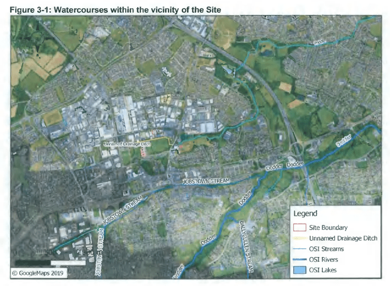
What is happening in the upper part of the river Poddle catchment?
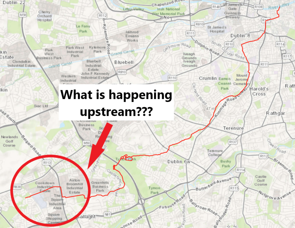
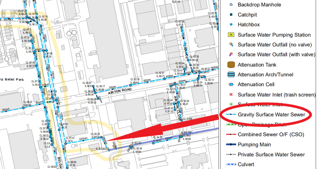
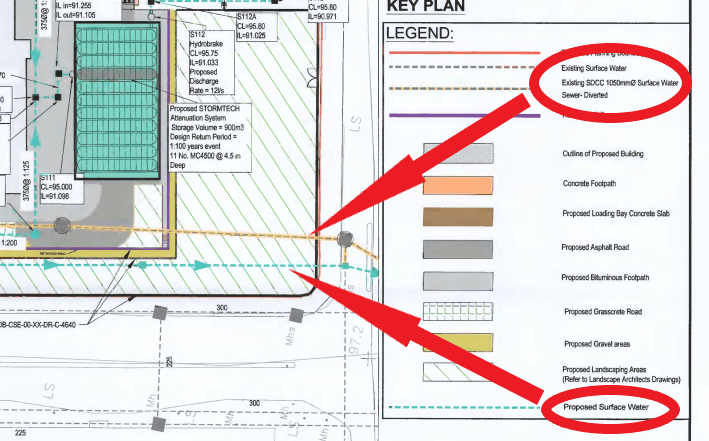
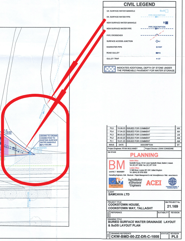
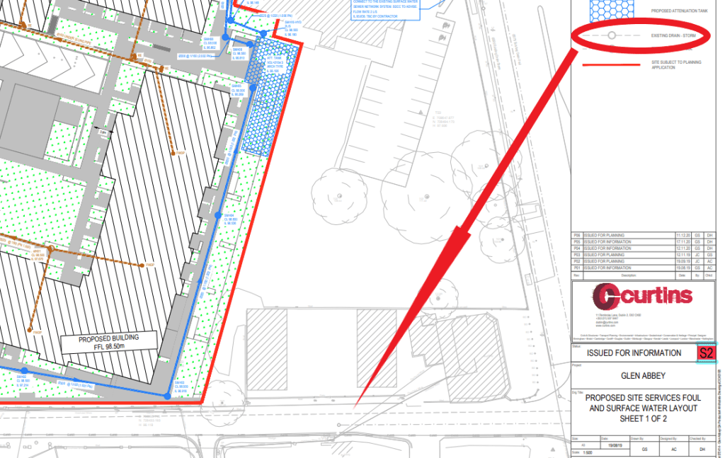
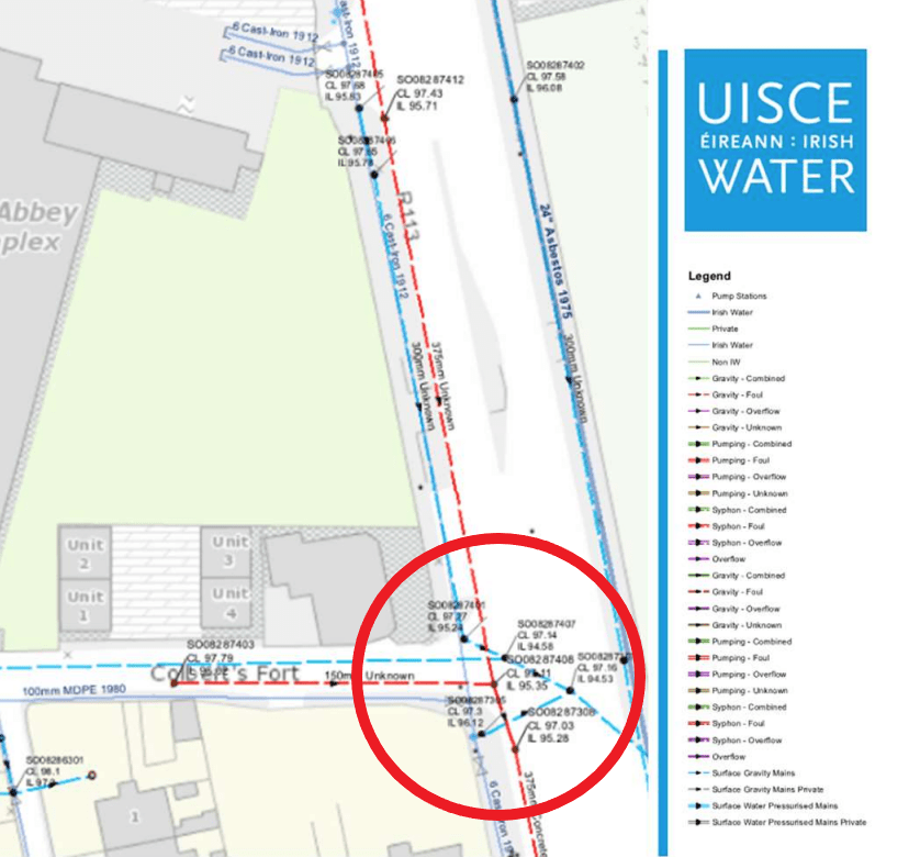
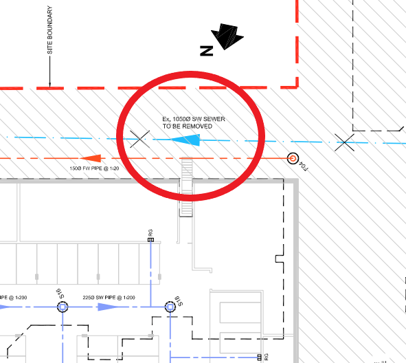
On paper, in this part of the catchment, looking at the Tallaght Town Centre Local Area Plan 2020-2026, plans were to re-open the river culvert wherever possible and to uncover its source in Cookstown. However, we are now in March 2025 and none of these plans has been realised. As most objectives of our urban development, plans to daylight the river Poddle are to be implemented by private “developers” and “in tandem with development”, but they have little interest in doing so. On the contrary, in the current real estate market policy context, their interest is to maximise land surface development opportunities, which is clearly at odds with making room for the river Poddle. Entrusting private actors with taking care of our rivers is a pipe dream. Our state and local government agencies themselves are actively supporting the erasure of the upstream part of the river Poddle by mapping its culvert as a surface water sewer. Planning applications that do so are also systematically approved. It results in the river Poddle being dropped from environmental, ecological and flood risk assessments at this location and there is little doubt that it will impact the entire catchment negatively.

Laure de Tymowski (09/03/2025)

3 thoughts on ““We need to go upstream & find out why they’re falling in!””