Did you know? Walking a river and its catchment are a great way to get to know them! Feet on the ground, you learn a lot about a river, and often much more than by just reading things about it! Most mainstreamed published sources of information about the river Poddle have been produced by state and local government representatives. Engaging with the river in person allows for other narratives, other stories, other river relationships to emerge (the “marginalised and deeply buried”).
The river Poddle flood justice walking tours focus on the flood management practices of the catchment: among other things, you will learn about the dramatic unfolding of past flood events, the main drivers of land management in the catchment, and what has been done and is being done to alleviate flood risk. The overall objective of the walking tours is to give a sense of how various forms of social and environmental inequalities are reproduced and reinforced through our current flood management practices in the catchment. In addition to flood management, other topics will be discussed as urban rivers are much more than just flood hazards! If you would like to arrange a walking tour, please get in touch at riverpoddles@gmail.com. Walking tours can be started at any location in the catchment and can be adapted to any mobility requirements. See you there!
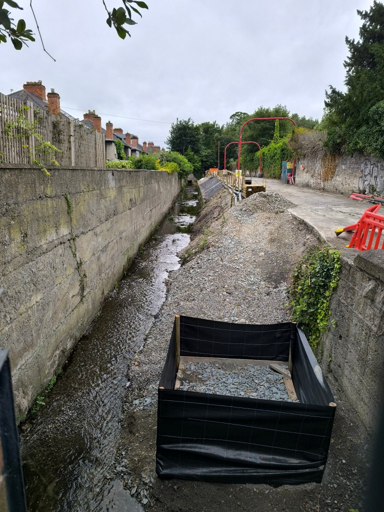
July 2025: Tommy walked some sections of the river Poddle as part of his research on flood management
On 11th of July, I was invited to be part of an online open conversation on flood adaptation in the river Poddle catchment kindly organized by Social Rights Ireland. Flood adaption is rarely if never genuinely discussed. A dominant assumption guiding flood adaptation is that engineering is going to make us safe! But there is nothing inherently good about flood alleviation infrastructure. As anything, the infrastructure is embedded in defined social, political, historical contexts. We must urgently create spaces to discuss, scrutinize, challenge our approach to flood adaptation: who decides, who gains, who loses and what kind of futures it promotes/forecloses!
Follow Social Rights Ireland on Facebook (@ConstanceMarkievicz), Twitter (@SocialRightsIRL) & Instagram (@socialrightsireland)!
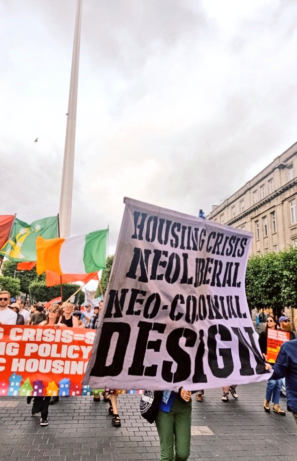
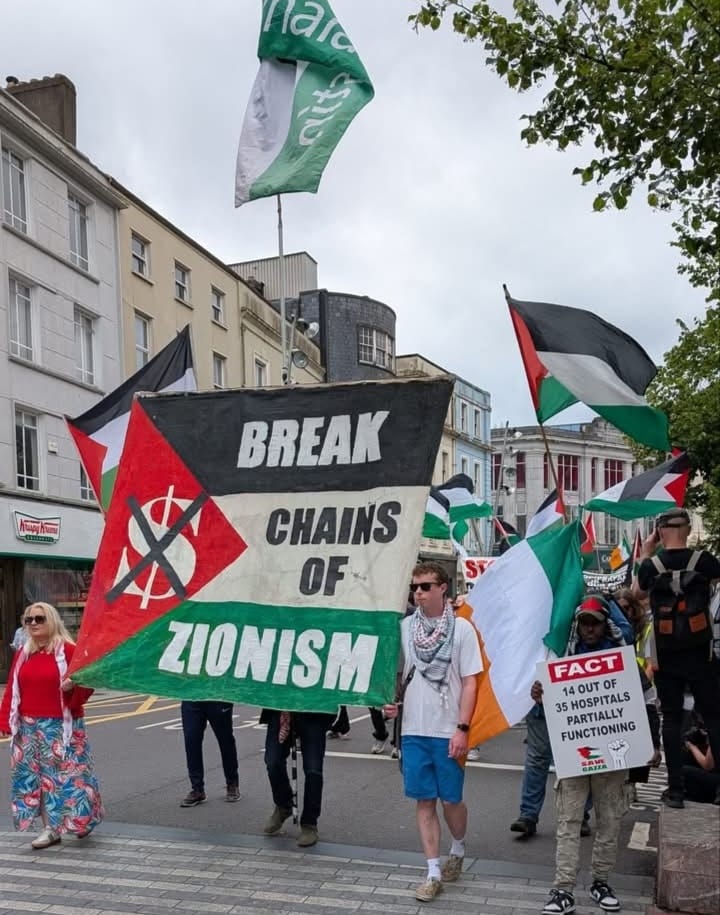
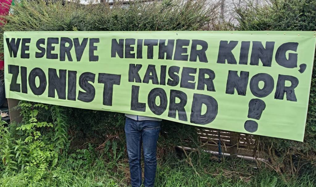
“Social Rights Ireland is an anti-imperialist, grassroots organisation in Ireland. Our allegiance is to the working class which is why we feel the subject of the Poddle FAS is relevant given that it highlights how democracy works to serve the interests of the ruling class while creating the illusion that the ordinary people of Dublin matter. Our recent activism is focusing on Breaking the chains of Zionism as the genocidal regime could not happen without the might of the Zionist empire. Ireland is not free, nor will be free as long as it is under imperialist subjugation. As James Connolly said: ‘Governments of capitalist societies are but committees of the rich to manage the affairs of the rich.’ We serve neither King, Kaiser nor Zionist.” (Róisín McAleer, SRI)
When talking about the river Poddle flood alleviation scheme, those involved in its conception and promotion have outlined its “nature-based solutions focus“. What they don’t say, however, is that the definition of what constitutes a “nature-based solution” remains largely unsettled and open to discussion. Marcus Collier and Mary Bourke, for instance, describe how “nature-based” is used to qualify a wide range of river catchment management practices wich may include “soft” or even “hard” engineering. Their own stance on the concept of “nature-based solution” is that it must include multiple long-term social, environmental, ecological benefits, which in turn asks the question of what/whose benefits should be sought and prioritized.
In short, if you are told about a particular project that it is “nature-based solution” focused, don’t feel intimidated and that it is the end of the conversation ! Far from it, the conversation is just starting ! Ask what is meant by “nature-based solutions” and to be given practical examples of what these solutions may look like. Ask what/whose benefits are pursued through them. Bring in your own perspective, your own experience and your own ideas. In the end, if not democratically debated and scrutinized, “nature-based solutions” will amount to nothing more than greenwashing.
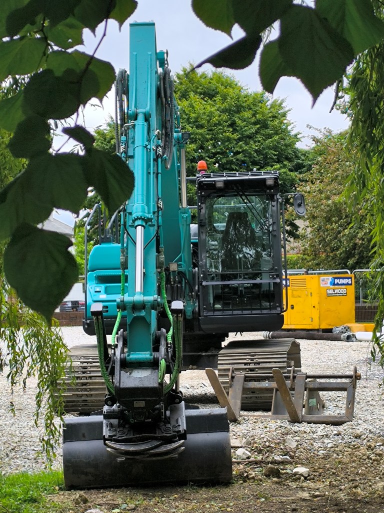
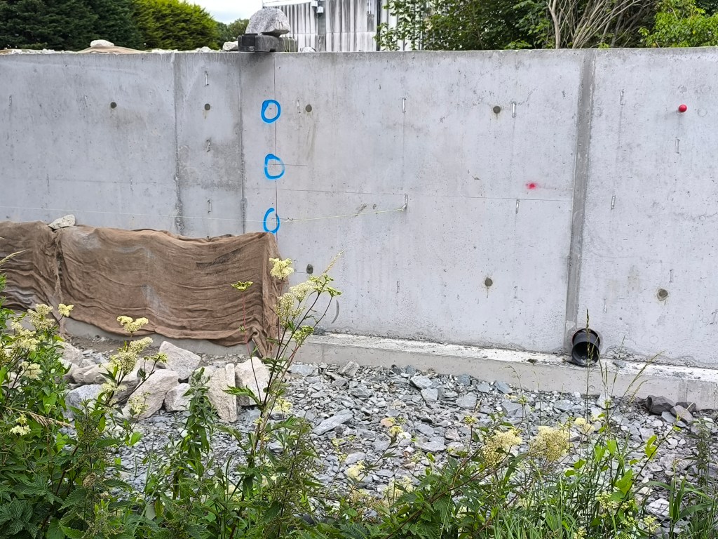
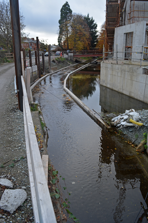
River Poddle flood works in Ravensdale Park (June 2025)
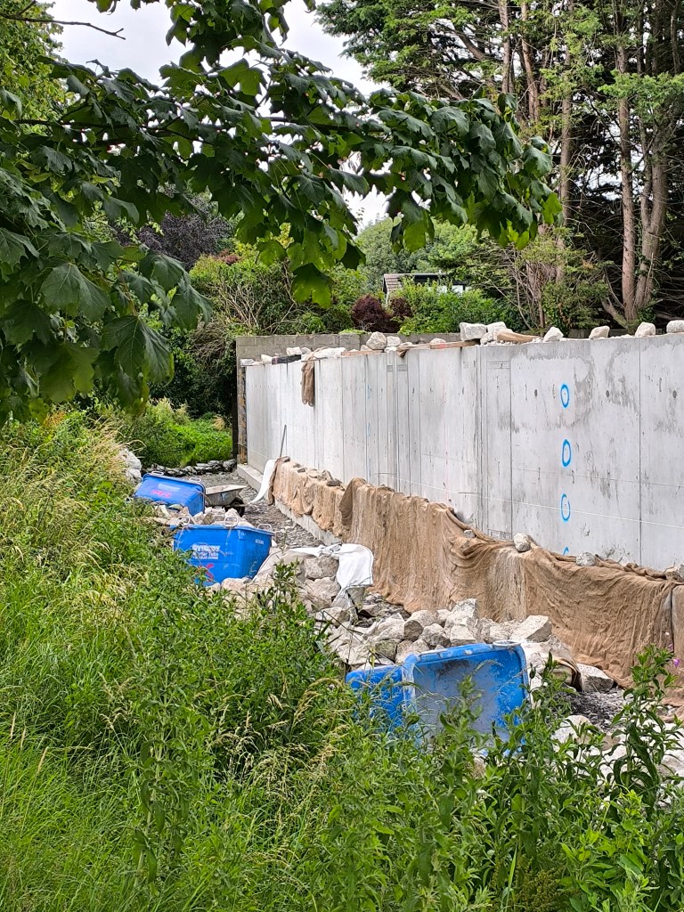
River Poddle flood works in Ravensdale Park (June 2025)River Poddle flood works in Ravensdale Park (June 2025)
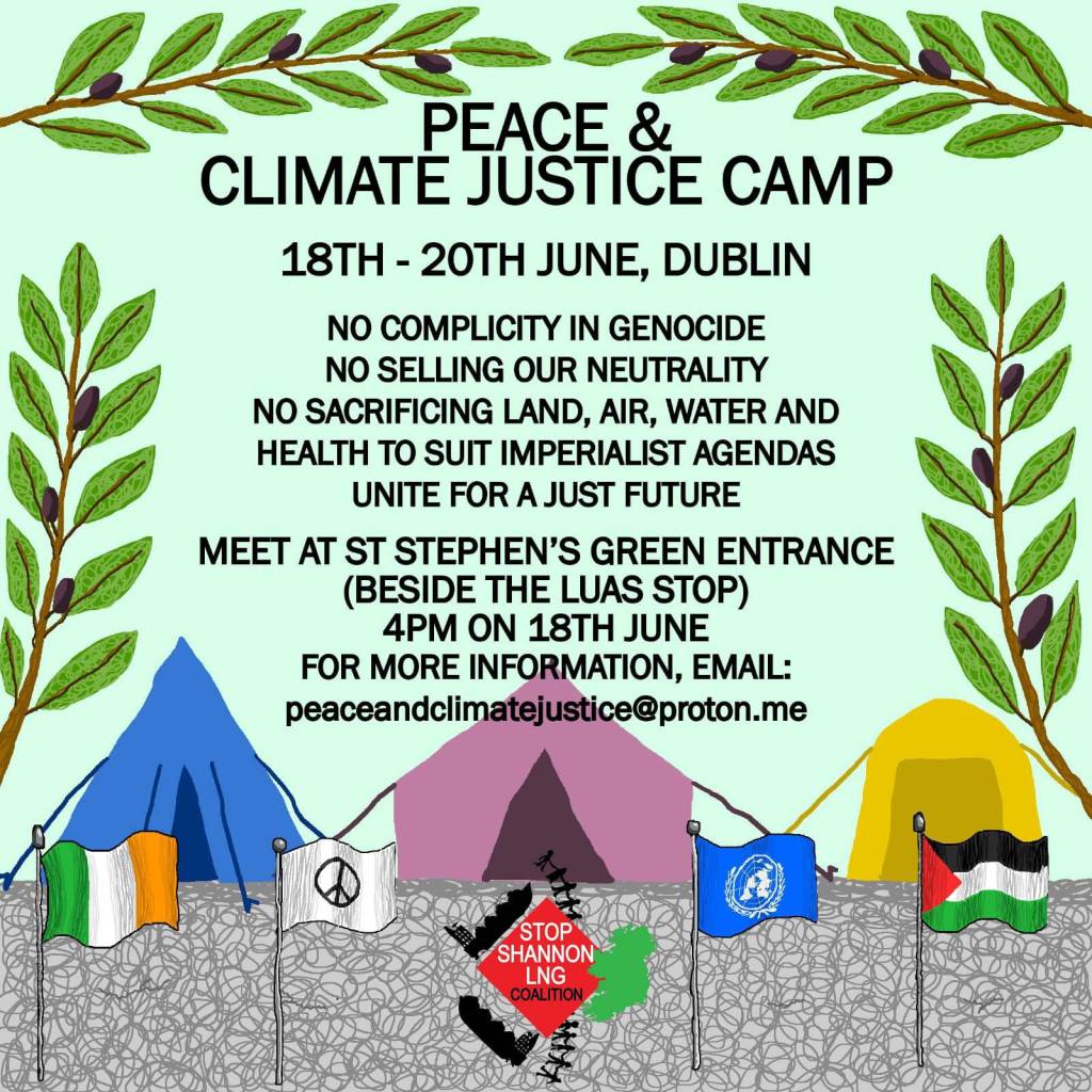
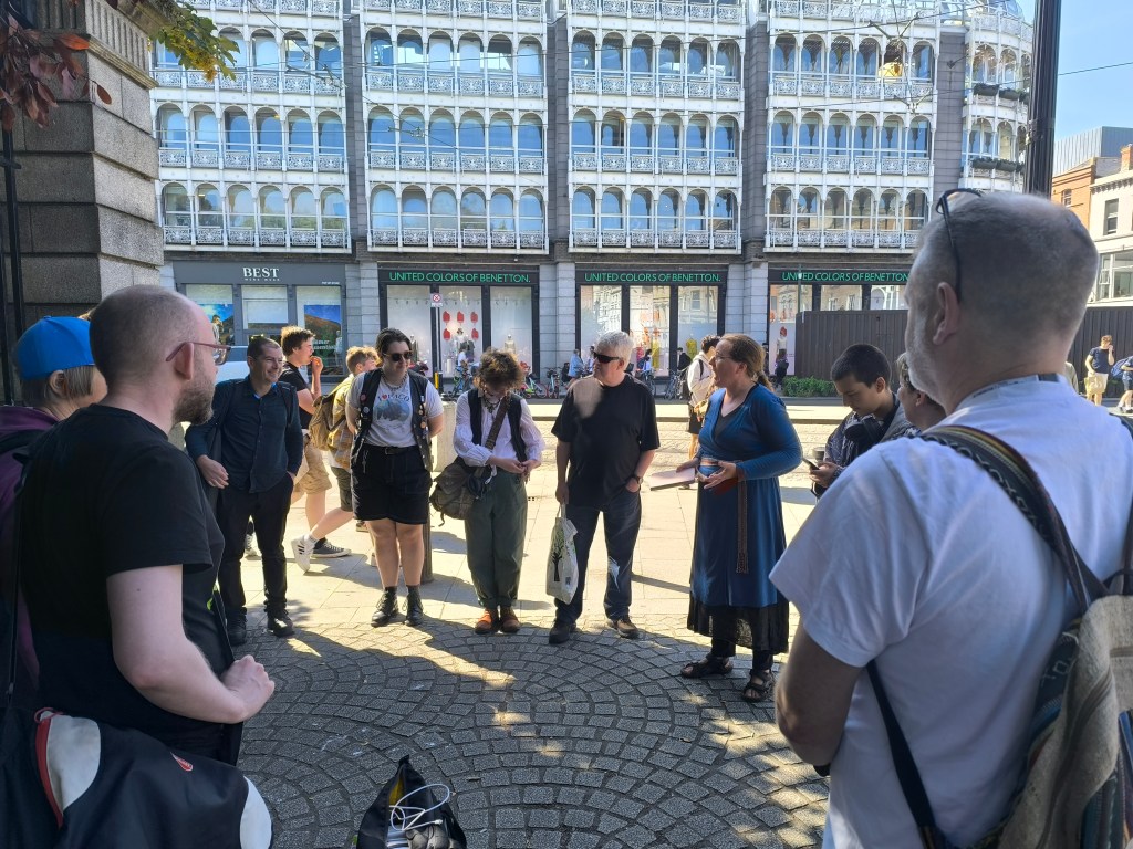
On the 18th of June 2025, I was invited to talk about flood adaptation and land/housing justice at the Peace & Climate Justice Camp 2025. The chosen location for the camp this year was Dublin. The meeting point for participants was one of St Stephen’s Green entrances. The specific set-up location of the camp in Dublin was to be decided during the first hour of the gathering. At 4pm, a group started to form.
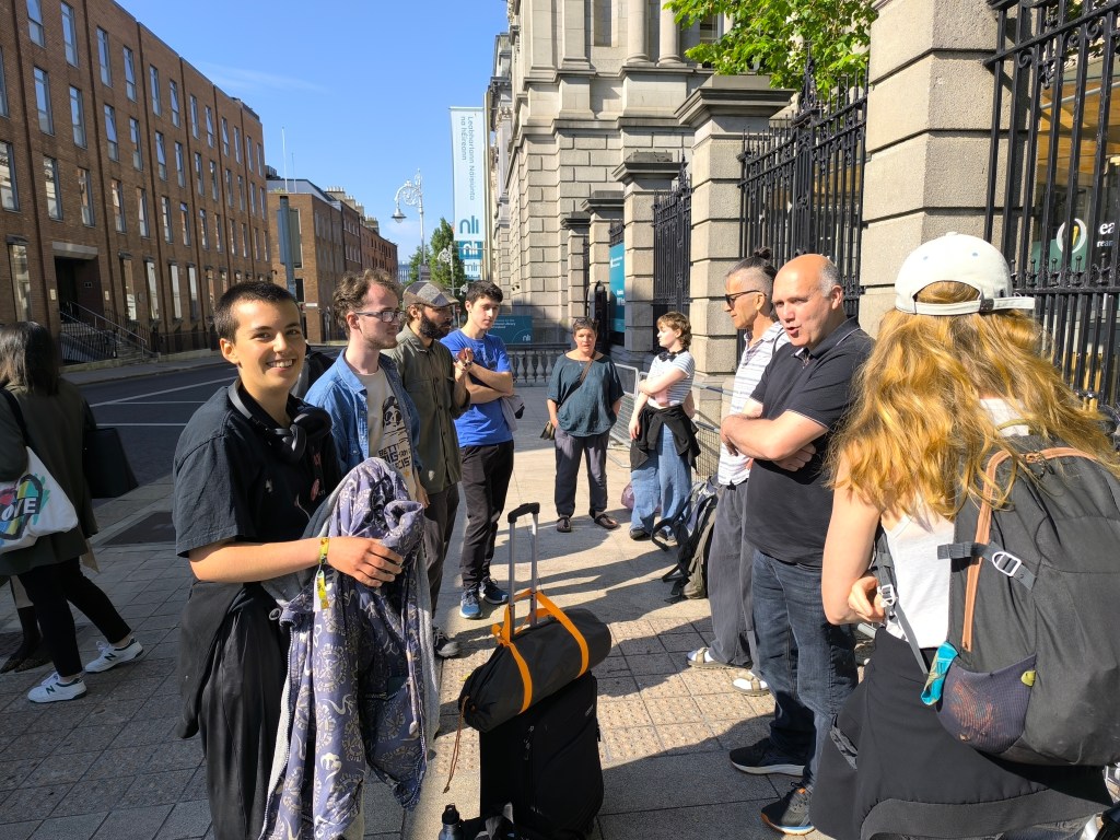
Meet at St Stephen’s Green Entrance!
At 4pm, a group is forming!
Here we are, a group of incredibly different people who have never met each other before for the most part, gathering in circle to decide together where the camp is to be set up. Discussions are organized so as to be as inclusive as possible. We are told that everyone must be given a voice and that we should all practice and improve our deep listening skills. These initial discussions are so well facilitated: instantly, we feel welcome and part of the group! We feel that our voices matter! To warm us as a collective, a fire prayer is sung.
The fire prayer
After a final round of deliberations, we make our way to Leinster House in Kildare Street, the collectively agreed location for the camp set-up!
Arriving in Kildare Street outside Leinster House
Holding our ground in Kildare Street outside Leinster House
While we are starting to set up the camp, a guard asks us if we are waiting for the bus : )
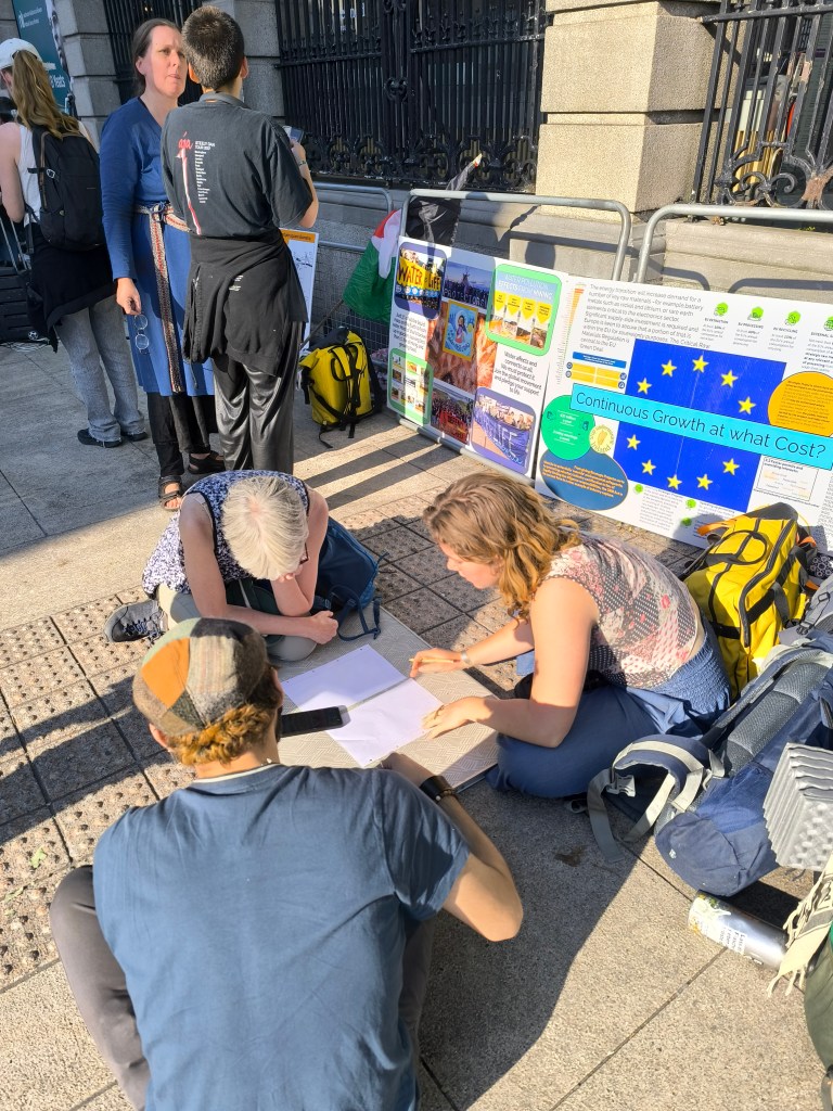
Discussing common words
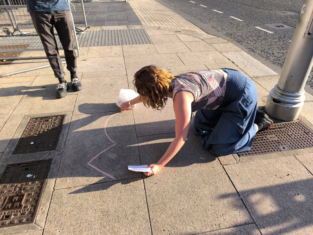
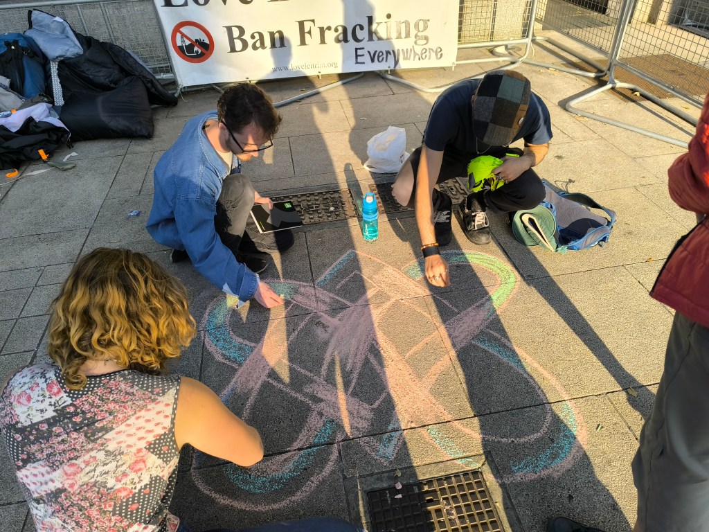
What words are to best represent everyone’s concerns? A small group starts working on finding common words for the camp. A logo is also discussed and, later on, chalked on the ground along with the words “Nature”, “Peace”, “Justice” in both Irish and English.
Logo chalking
River Poddle talk at the Climate Justice Camp
After dinner, I give a brief insight on my research on the politics of flood adaptation in the River Poddle catchment, highlighting how property developers’ greed compromises flood safety, housing security and any alternative futures for the River Poddle. Flood adaptation can only be achieved through land justice!
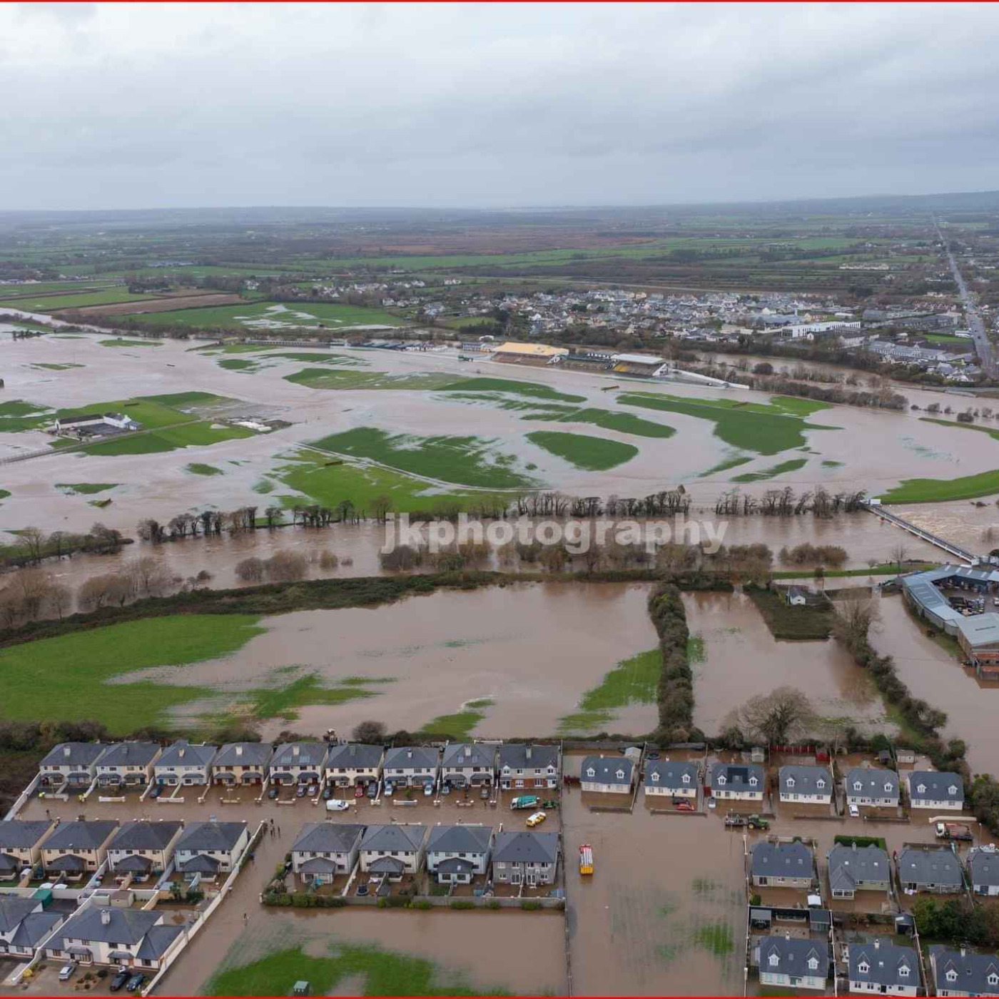
A central message from the camp is that many of our struggles, if not all, are intimately connected. The traditional urban/rural divide, in particular, must be challenged. Speaking with some of the camp’s organizers, clear links were drawn between the politics of ‘flood adaptation’ conducted in the River Poddle catchment and in north Kerry (see great podcast by Eoghan and Kate below!). A main common thread is, no doubt, land justice. So let’s unite and fight back together!
This week Eoghan talks to Kate Carmody about the fallout from storm Bert in north Kerry, which laid bare years of bad planning by Kerry County Council. Hosted on Acast. See acast.com/privacy for more information.
PAPER ABSTRACT: Water models are world-making devices that stabilise or remake social structures and power relations. This has spurred calls for deeper explorations of how models are situated within historical and political contexts. The paper examines the flood model used for flood management planning in the River Poddle catchment in Dublin, Ireland. Starting from the death of Celia de Jesus during a 2011 flood in this catchment, we argue that Dublin’s neoliberal property regime is an essential context for situating this model. Using a method grounded in discourse analysis and interdisciplinary dialogue, our situating approach follows the modelling process across two levels: the policy context and the model outputs and outcomes. Irish flood management policy sets strong boundaries for modelling, while embedding property assumptions in the model’s aims, scenarios and maps. Model outputs are shown to effectively serve the interests of real estate actors while negatively impacting those marginalised in property relations. Our critical situating has important implications for those hoping to use or critique models in order to challenge injustice.
“There comes a point where we need to stop just pulling people out of the river. We need to go upstream and find out why they’re falling in.”Desmond Tutu
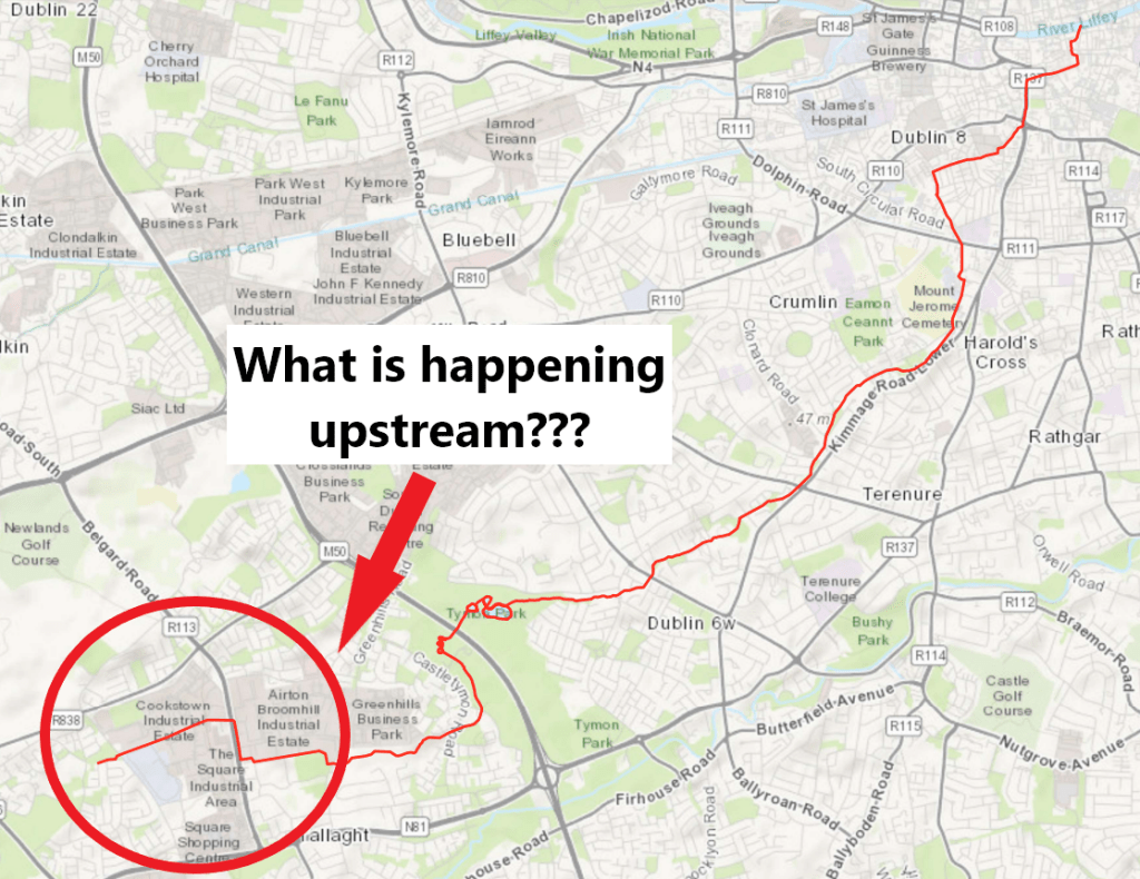
What is happening in the upper part of the river Poddle catchment?
The river Poddle
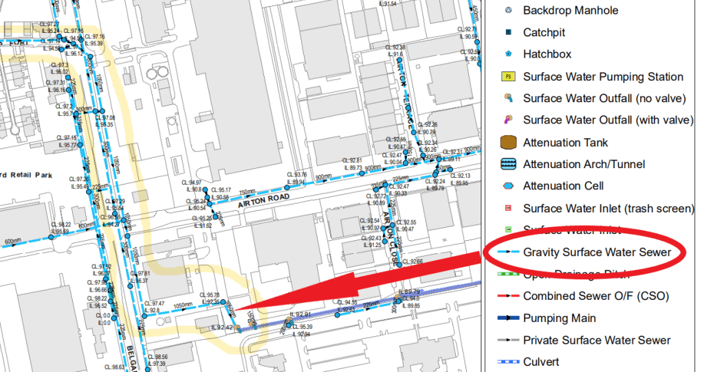
On paper, in this part of the catchment, looking at the Tallaght Town Centre Local Area Plan 2020-2026, plans were to re-open the river culvert wherever possible and to uncover its source in Cookstown. However, we are now in March 2025 and none of these plans has been realised. As most objectives of our urban development, plans to daylight the river Poddle are to be implemented by private “developers” and “in tandem with development”, but they have little interest in doing so. On the contrary, in the current real estate market policy context, their interest is to maximise land surface development opportunities, which is clearly at odds with making room for the river Poddle. Entrusting private actors with taking care of our rivers is a pipe dream. Our state and local government agencies themselves are actively supporting the erasure of the upstream part of the river Poddle by mapping its culvert as a surface water sewer. Planning applications that do so are also systematically approved. It results in the river Poddle being dropped from environmental, ecological and flood risk assessments at this location and there is little doubt that it will impact the entire catchment negatively.
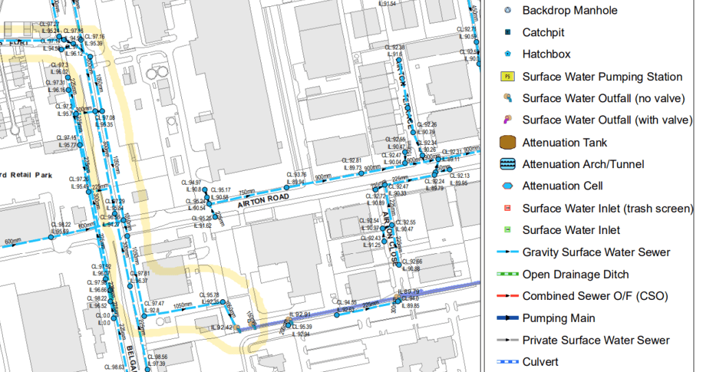
South Dublin County Council mapping of the river Poddle culvert as “Gravity Surface Water Sewer”
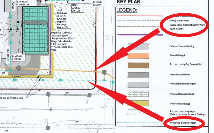
Amazon mapping of the river Poddle culvert as “Surface Water Sewer” and proposal to divert it to make room for their second Airton Road data centre (planning application: SD18A/0219)
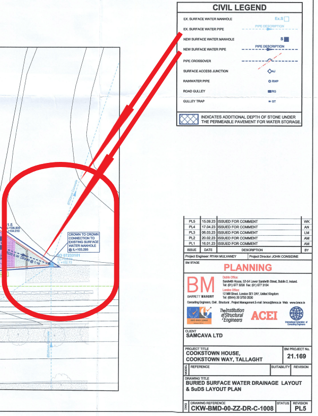
The river Poddle culvert mapped as “surface water pipe” and connected to “new surface water pipe” to be added as part of a forthcoming development (planning application: SD23A/0237)
The river Poddle culvert mapped as a mere existing pipe on the site of a new development (planning application: SD20A/0050)
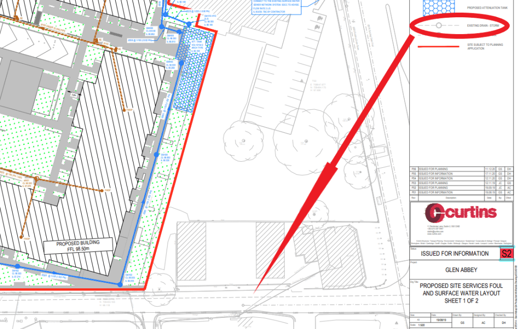
The river Poddle culvert mapped as “existing drain storm” (planning application: SHD3ABP-309916-21)
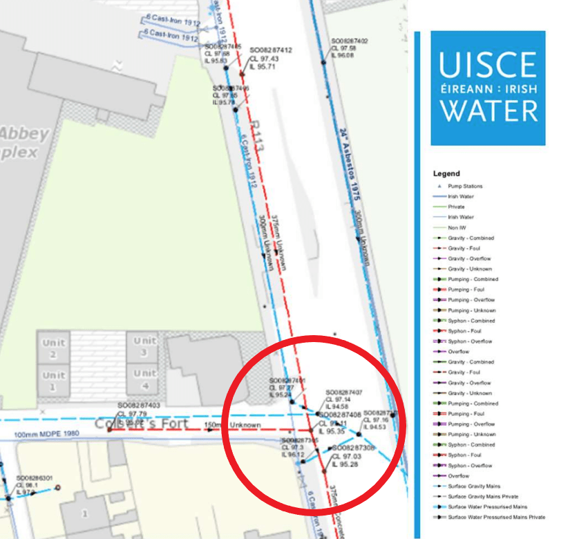
New development surface water drain connected to the river Poddle culvert mapped as “Surface Gravity Mains” by Irish Water (planning application: SHD3ABP-309916-21)
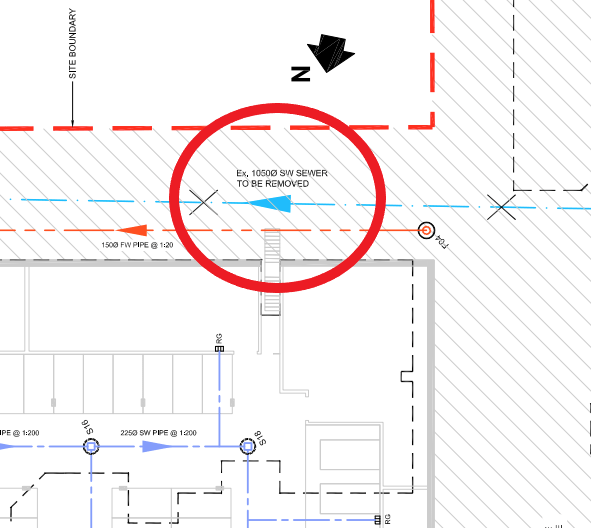
River Poddle culvert mapped as “SURFACE WATER SEWER TO BE REMOVED” on plans for a new development (planning application: SHD3ABP-305763-19)
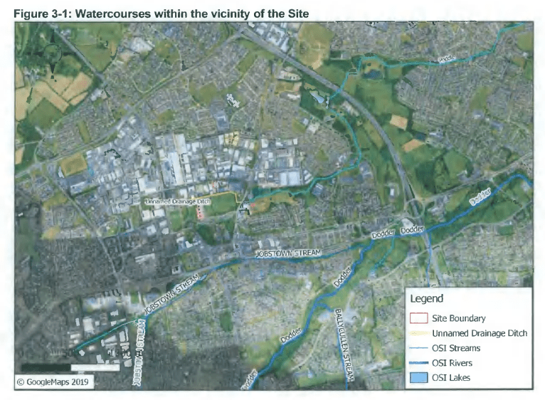
River Poddle mapped as “Unnamed Drainage Ditch” in ‘Appropriate Assessment – Stage 1 – Screening Report’ for a new development (planning application: SD19A/0346)
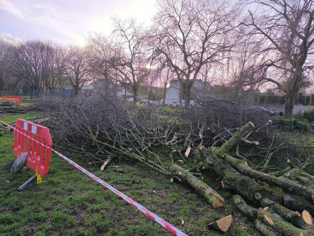
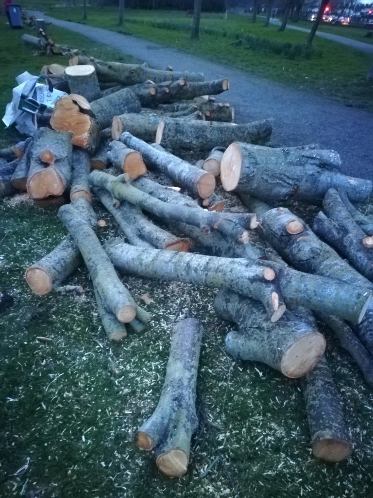
Tree removal as part of the river Poddle flood alleviation scheme works in Ravensdale Park (February 2025)
Tree removal as part of the river Poddle flood alleviation scheme works in Tymon Park (February 2024)
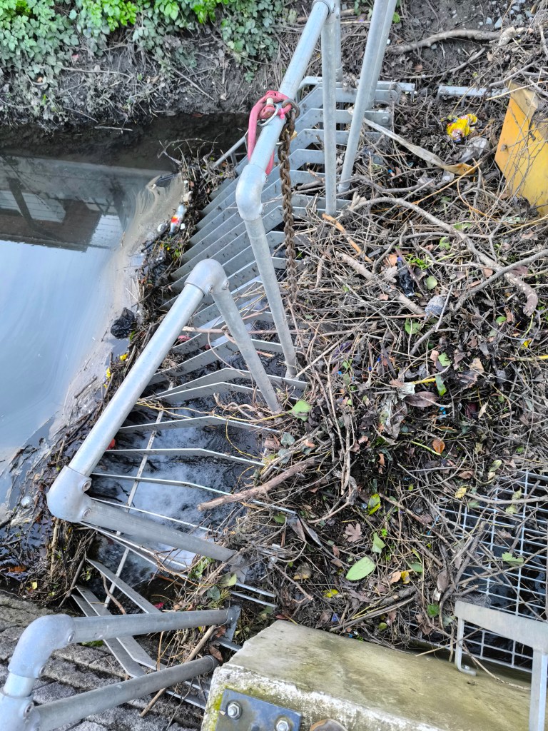
River Poddle trash screen left unmaintained for days at Mount Argus Apartments in February 2025 (owned by global real estate investment fund Patrizia who has currently €56bn of assets under management)
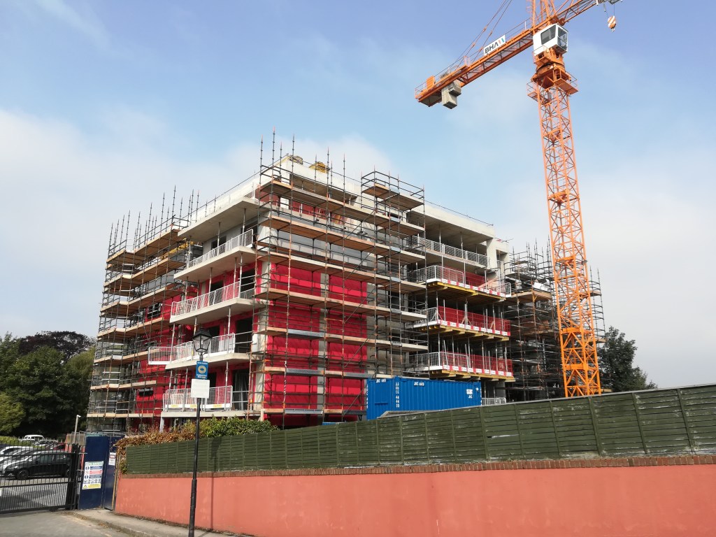
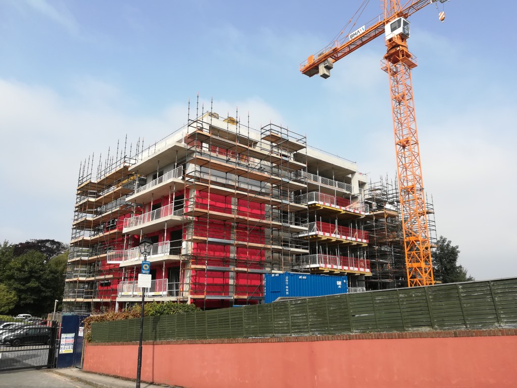
New build-to-rent by Rivergate Developments meters away from the river Poddle in Flood zone B in well-known flood-prone location (September 2024)
“My earliest memory of the Poddle is my Dad, I was only a young lad, 8 or 9 years of age, and my Dad would take me on the crossbar of the bike and we would go up to the Poddle and fish, we call it pinkeens, the little fish, but now and again, when I was with my Dad, we’d seen a catfish and I thought they are very lovely-looking (…) that was one of my happiest memories.”
CHAPTER 1 For me, it all began back in 1942 when I was 4 years old. My Dad would say to me “right hop up on the crossbar of the bike”. He would take me down to the Grand Canal and we would feed the swans, ducks and seagulls. That was my first taste of nature. I used to love this. We would continue on our journey all the way down to Sandymount Strand. I used to be fascinated at the way the sun would shine on the water and create ‘Diamonds’. Even since when I see ‘diamonds’ on the water I think of my Dad. As I am now 82 that was a long time ago.
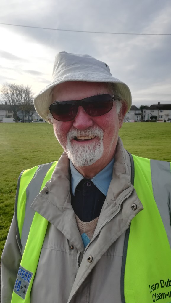
CHAPTER 2 Other times he would take me fishing for pinkeens up to the river Poddle. I loved the river and the sound of running water. I joined the Crumlin Community Clean-up Group in 2019 and one of our tasks was the clean-up of the river Poddle. It brought back happy memories. I always thought that it was very uncaring of people to pollute the river like this. The clean-up group were really lovely people. I am so glad to have them in my life.
Sean on his way to a river Poddle clean-up (November 2019)
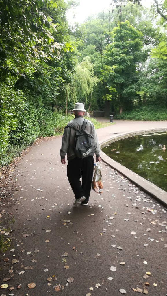
CHAPTER 3 “Our Gang” on Kells Road loved going for rambles up to Lady Shaw’s Woods. It is also known as Bushy Park. It is a well-kept beautiful park with its lovely lake packed with wildlife. One of my old-time favourite sights is to see “diamonds” on the lake and a swan family preening themselves. My love of the beauty of nature is being carried on by my family and grand children. I would tell them all about my childhood adventures and the fear we had of Lady Shaw who lived in the big haunted house behind the magic house. The haunted house was now gone. Many are the films I compiled of this beautiful lake so well-maintained with its abundance of wildlife. We would then go fishing for pinkeens on the river Dodder. I used to swim here a lot as a young lad.
Sean leading our walk in Bushy Park (June 2020)
CHAPTER 4 My wife had the same love of nature as I. We used to love going to the Pine Forest and walking by the mountain stream down through Glendoo Valley and down to Johnnie Fox’s Pub where we had our lunch. We loved the area so much that in 1995 we bought our grave up in Mount Venus Cemetery. My wife Rita passed away in 2013. So many memories come to my mind when I pay her a visit. One time my son John and family took Rita and I for a spin up to the Pine Forest. We had our picnic by a mountain stream. I just love the sound of running water. We cooked sausages on the open fire. They were as black as cinders when cooked but we still ate them. We all survived that. I swear I can still get the smell of burnt sausages when I am in the area.
CHAPTER 5 As a young lad I went for a ramble with my pals and eldest brother Seamus. We went to what had been a quarry up on Whitewall Road, just pass the Submarine Pub. It was being landscaped and the quarry lake was being stocked with fish (the lake has since been filled in and is now a football field called the Eleven Acres). My brother Seamus had gotten a new fishing rod. I asked could I have a go and he said no. I made up my own fishing rod. I got a piece of stick, my shoe lace and a bit of wire. Well, surprise, surprise, I was the only one to catch a fish. I was so proud. I kept that fish at home in the bath. When anyone wanted to have a bath, they had to take out the fish and put it in a basin. I had made a net for this purpose from one of my mother’s nylon stockings. I had Jonah the fish for 6 months before he died. I was heartbroken. Nemo was not a patch on him.
In 2020, the river Poddle flood alleviation scheme planning application was submitted to An Bord Pleanála for review. At this stage of the process, residents who wished to submit observations had to pay a €50 fee. In 2023, the proposed flood scheme was approved, and, in April 2024, the flood scheme works were launched in Tymon Park, South Dublin. However, if we look at Flood Risk Assessments in planning applications, we can see that the implementation of the flood alleviation scheme was decided and agreed on long before the planning application was submitted to An Bord Pleanála for review! While we are made to believe that our voices count and asked to pay €50 to make them heard, public authorities and private developers are the ones and only decision-makers!
In 2015 for instance, a planning application for a student accommodation in the Liberties was approved on the basis that the river Poddle flood alleviation scheme would soon be completed (planning application reference: 3475/14). The development site intersects with the river Poddle culvert, is located in flood zone B and plans required the diverting of one of the river overflow culverts. The developer was Global Student Accommodation, which is now “located in nine countries with circa $6 billion of assets under management” and the “trusted partner globally to some of the world’s leading institutional investors”. The 2014 Flood Risk Assessment states that “the possible flood risk along Mill Street should be completely mitigated” by the proposed river Poddle flood alleviation scheme, and that based on conversations with Dublin City Council, the scheme “is approximately 2 years from commencement” (consultant: Barrett Mahony). In other words, 9 years prior to the scheme statutory planning approval, developers had already received the assurance that it would be implemented!
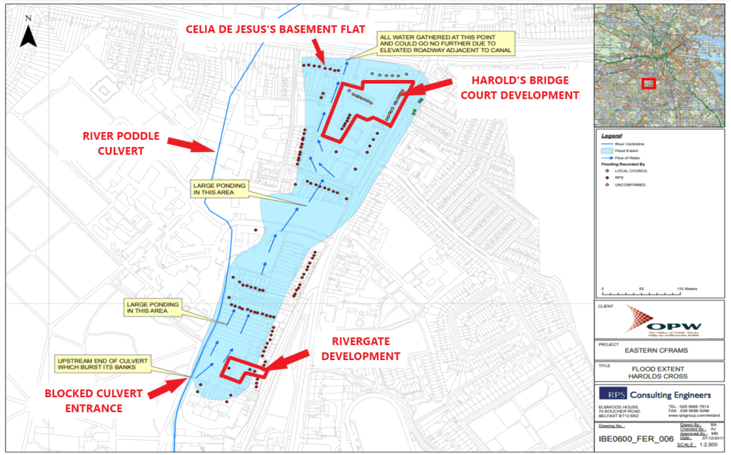
Two other developments located in flood zone B and on the 2011 Harold’s Cross flood extent map tell a similar story. The first one is a build-to-rent apartment project led by Dublin and London-based property developer Rivergate Developments. The development was approved in 2019 on the basis that flood risk would be mitigated by the forthcoming river Poddle flood alleviation scheme (planning application reference: 0374/20). However, the Flood Risk Assessment submitted as part of the planning application was produced before the publication of the first official design of the scheme in 2018 and therefore based on initial rough drafts (consultant: JBA). Furthermore, as in the Liberties development case, there are obvious signs of ongoing conversations between the developer’s consultants and public authorities and again it seems taken for granted that the scheme is to be implemented shortly whereas at this time it had not even reached planning submission stage: “Construction is due to begin in 2020, with completion in 2022.”.
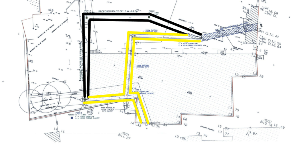
The second one, Harold’s Bridge Court, differs slightly in that it was approved in June 2024 so after the commencement of the flood scheme works in April 2024 (planning application reference: LH29S.319421/LRD6036/24-S3). However, the Flood Risk Assessment, published in 2023, refers to similar exchanges between the developer’s consultants and the local authority and to a similar engagement that the proposed flood scheme is to be implemented in the near future before it is formally approved in 2023: “Following discussions with the DCC Flood Defence Projects Office in June 2022 we note these works are now due to commence in 2023.” (consultant: DBFL)
The Rivergate build-to-rent development in Harold’s Cross